An earthquake with a strength of 7.7 hit Myanmar on Friday, followed by a strong aftershock of 6.4.
The Indian Space Research Organisation (ISRO) has shared satellite images showing the widespread damage caused by the 7.7 earthquake that affected Myanmar and nearby countries on Friday.
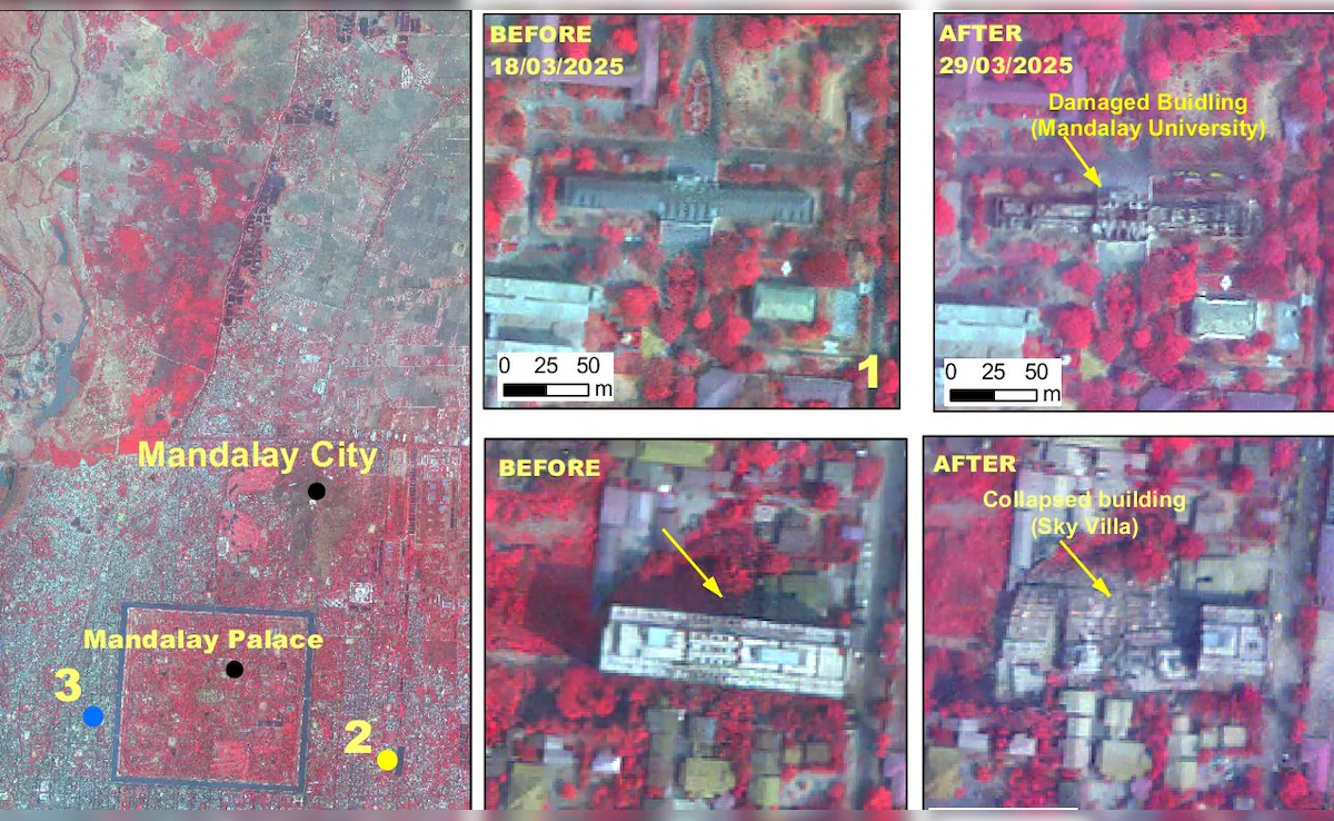
ISRO used its advanced Earth imaging satellite, Cartosat-3, which can capture images with a resolution of less than 50 centimetres. The satellite took photos from 500 kilometres above Earth. The images show the collapse of a large bridge over the Irrawaddy River, damage to Mandalay University, and the fall of the Ananda Pagoda.
ISRO’s space agency says Cartosat-3, launched in 2019, is a high-tech satellite used for taking detailed images of Earth. It is a rare event when ISRO releases images from this advanced satellite.
The National Remote Sensing Centre, which is part of ISRO, said they got images from Cartosat-3 on Saturday, showing areas in Mandalay and Sagaing in Myanmar after a disaster. They also used Cartosat-3 data from March 18 to check for changes and assess the damage. They found heavy damage to buildings in Mandalay city.
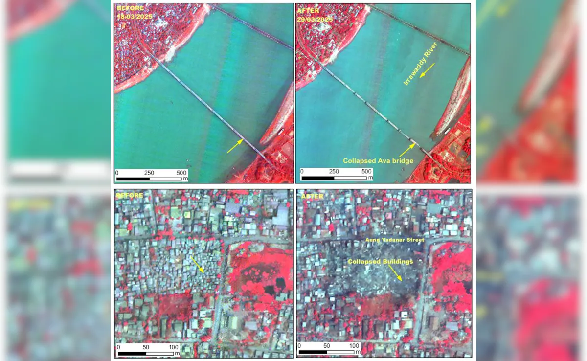
Mandalay city and Ava bridge were badly affected.
On Friday, an earthquake with a strength of 7.7 hit Myanmar, followed by a strong aftershock of magnitude 6.4. The earthquake’s epicenter was 10 km deep near the Sagaing-Mandalay border. Mandalay, Myanmar’s second-largest city, experienced severe damage.
The earthquake also affected Myanmar’s capital Naypyidaw and other areas, causing buildings, roads, and houses to collapse. The earthquake’s shaking was felt in neighboring countries, even reaching Chiang Mai and northern Thailand, where some places also reported damage.
The images showed heavy damage in Mandalay, with famous places like Sky Villa, Phayani Pagoda, Mahamuni Pagoda, Ananda Pagoda, and the University of Mandalay either fully or partly damaged.
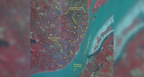
In Sagaing city, buildings like the Ma Shi Khana Pagoda and several monasteries were also harmed.
The damage to Mandalay city.
The earthquake caused the historic Ava (InnWa) Bridge on the Irrawaddy River, near Inn Wa City, to collapse. There were also cracks in the flood plains of the Irrawaddy River, and signs of ground shaking (liquefaction) were seen.
According to ISRO’s damage report, Myanmar is located near the meeting point of the Indian and Eurasian plates. The Indian Plate is moving north toward the Eurasian Plate at a rate of about 5 cm per year.
Myanmar is also close to smaller fault lines, like the Sagaing Fault, which runs through central Myanmar. The Sagaing Fault is an active fault that allows movement between the Indian and Eurasian plates. The earthquake on Friday was likely caused by stress buildup along the Sagaing Fault or its smaller faults in the area.
India was one of the first countries to send rescue teams and help Myanmar.
Published: 1st April 2025
For more such articles please follow us on Twitter, Linkedin & Instagram
Also Read:
Eid al-Fitr 2025: Key Celebrations & Traditions to Expect
The Best Beauty Hacks for a Flawless Look on a Budget
Microsoft warns 1B Windows users: Stop using passwords


 and Formalizes Its Transition Toward a Blockchain-Based Cultural Infrastructure Model")


")


